
New York City Neighbors by Block
Public sources describe different parts of a block. A parcel viewer shows lot geography. A property record can show an owner of record and tax context. Recorded instruments show transactions involving a lot. Building databases show permits, complaints, violations, or registrations. None of those sources turns mapped adjacency into a list of people who live together. The block view below keeps the access and evidence limits visible.
| Source | Block View | Access |
|---|---|---|
| PIP borough/block mode | Tax lots for a block, property details, owners, values, and exemptions | Free public map and list |
| ZoLa | Adjacent parcel shapes, zoning, land use, historic, waterfront, and administrative layers | Free map with click and browse |
| GeoSupport 1B, 3, and 3S | Blockface, cross streets, and political or geographic attributes | Free service or API |
| ACRIS | Recorded transfers, mortgages, liens, parties, and parcel references for a BBL | Free index and available images in four boroughs from 1966 |
| BIS, DOB NOW, and HPD | Building permits, filings, complaints, violations, registration, and litigation | Free public searches; use both DOB systems |
| NYC BOE | Known-person registration match and election-district context | Exact five-field form; restricted voter-file route |
| Community boards | District boundaries, meetings, managers, and civic contacts | Official civic information, not member rosters |
For historical context, directories, Sanborn maps, property cards, and tax photographs add different dates and evidence types. Use them to understand the block's past rather than to make a present-tense household claim.
Note: Each block source records a different relationship, so preserve the source, access date, parcel, and event date.
New York City Neighbor Parcel Method
A mapped neighbor is an adjacent tax lot, not necessarily the nearest household. Dense blocks can contain a corner building, multiple entrances, several tax lots, condominium units, air lots, or subterranean lots. Define adjacency by a shared lot boundary or street frontage, not by distance on a screen. ZoLa can locate an address, BBL, BIN, or point on the map and then provide a lot panel and related geographic layers.
ZoLa's public parcel viewer is the starting map for the adjacent-lot method.
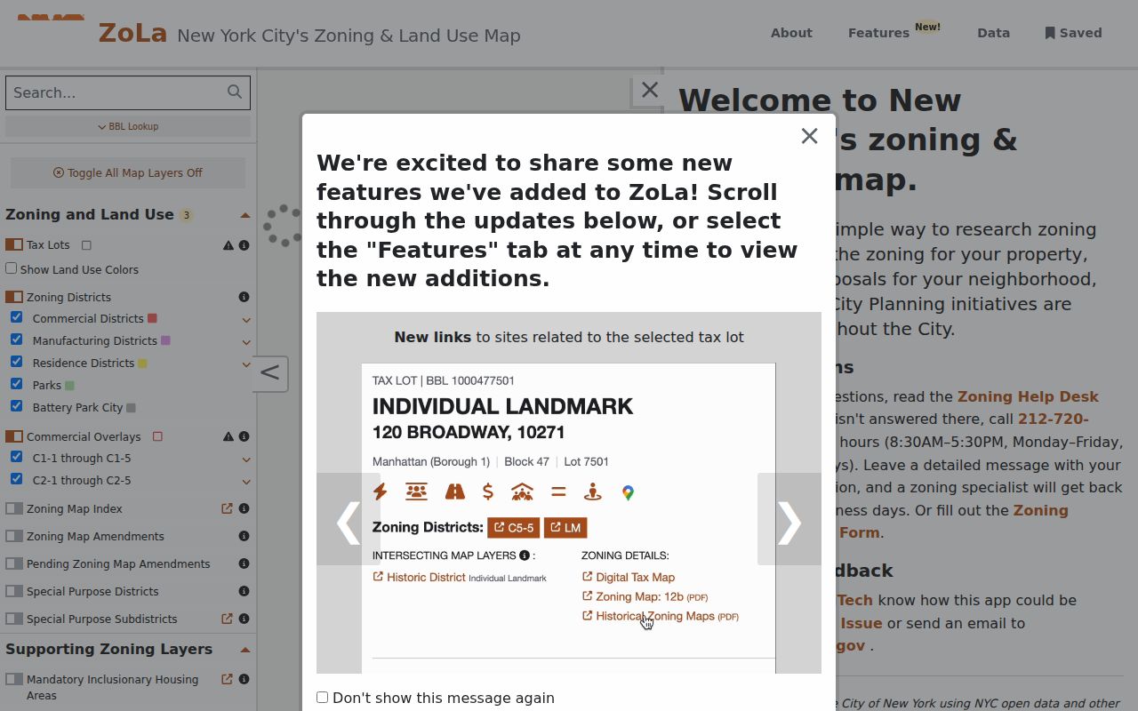
The viewer makes lot boundaries and map context visible, but the city describes its GIS display as informational rather than a survey or conveyance document.
- Locate the target by address, BBL, BIN, or map interaction, and record the borough and exact address form.
- Turn on parcel or lot boundaries and identify lots that share a boundary or the relevant street frontage.
- Click each lot and record its BBL, situs address, zoning or land-use layer, building count, and related links.
- Use GeoSupport's address, street, street-stretch, or BBL functions to normalize cross streets and the blockface.
- Move each BBL to PIP, ACRIS, BIS, DOB NOW, and HPD for the specific public record type needed.
There is no universal city radius resident list in the inspected portals. A corner building or multi-address lot needs the legal lot boundary and its BBL, not an assumed radius around a pin.
New York City Neighbor Record Trail
PIP and ACRIS answer different questions after an adjacent lot is identified. PIP can begin with address, BBL, borough/block, condominium, co-op, REUC, air-lot, or subterranean-lot modes. It returns property and tax context, including owner or owner-of-record information and recent-recording links after a property search. ACRIS then supplies recorded-document routes for Manhattan, Bronx, Brooklyn, and Queens.
ACRIS Find Addresses and Parcels supplies a borough, house number, street, unit, block, and lot bridge to the BBL.
Use that bridge to tie a map result to the correct parcel before opening a recorded instrument.
The NYC Property Information Portal displays the city's property-search modes before a detail record is opened.
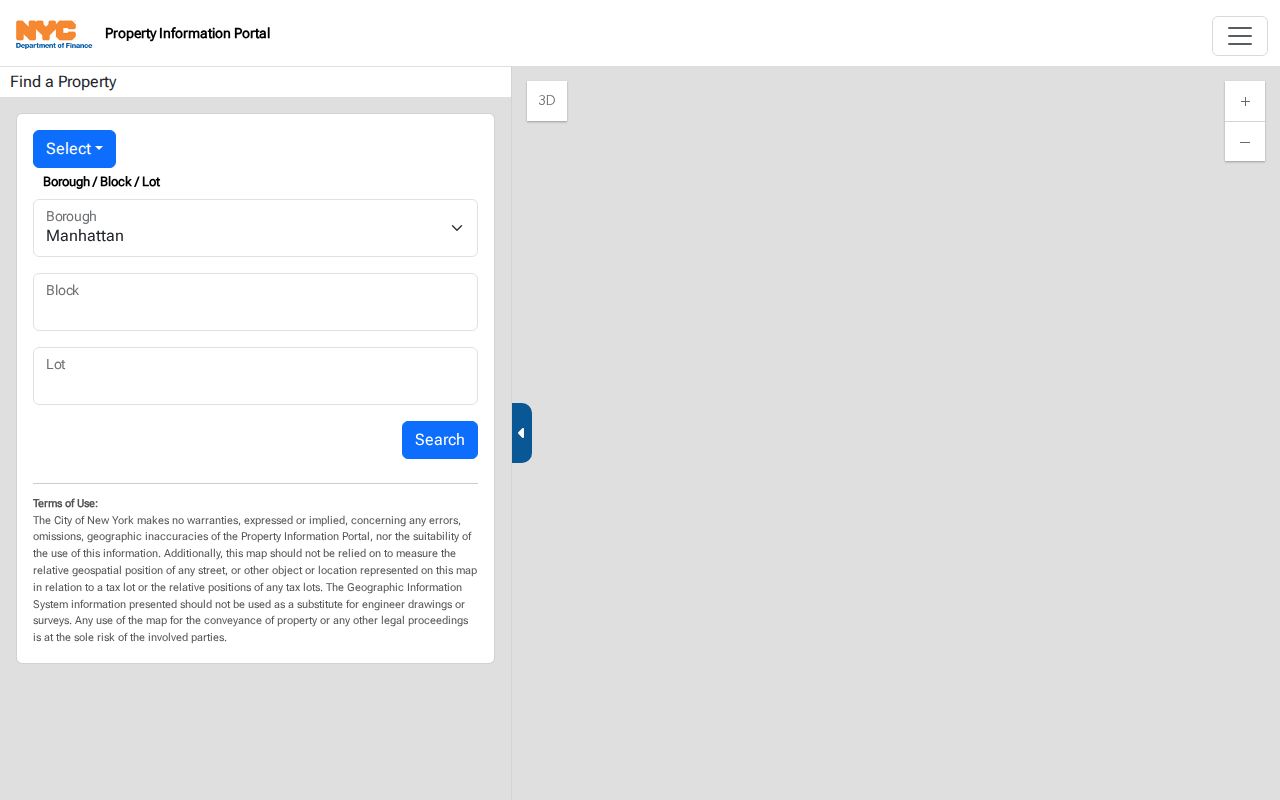
The available modes help resolve unusual parcel forms, but a search result should still be read with its date and source type.
Separate situs, the parcel's location, from a mailing address, where tax or official notices are sent. A mailing address may belong to an office, representative, entity, or other property. It does not prove that the recipient lives on the block. Likewise, a recorded party can be a seller, buyer, lender, attorney, trustee, or representative rather than an occupant.
New York City Neighbors and DOB
Building history helps describe a parcel without guessing about people. Search BIS and DOB NOW because the city separates their coverage: DOB NOW filings do not appear in BIS. BIS can show property details, applications, inspections, permits, complaints, violations, actions, and licensed-trade information. DOB NOW contains newer filings, certificates, compliance material, and violations. HPD adds complaints, violations, registration, charges or litigation, BBL, and vacate-order material.
For a full block, repeat the search for each BBL or address. Plans do not appear in the public DOB NOW portal; drawings, plans, microfilm, docket books, reels, I-cards, index cards, and curb-cut cards follow DOB's request process and can require pickup at the relevant borough office. A permit or complaint identifies a property event, not proof that a named applicant lives there.
Note: Date each parcel result because a permit, recorded transfer, tax record, and HPD entry describe different events.
New York City Civic Neighbors
Community boards add a public civic layer around a block. New York City has 59 official boards: 12 in the Bronx, 18 in Brooklyn, 12 in Manhattan, 14 in Queens, and 3 on Staten Island. They are appointed advisory bodies, not household directories. District-manager contacts, meeting calendars, district boundaries, and public civic links are legitimate ways to understand an area's civic structure.
| Official civic context | Examples named on community-board resources | Appropriate use |
|---|---|---|
| Queens civic contacts | Bellerose Commonwealth Civic Association, Cambria Heights Civic Association, Federated Blocks of Laurelton | Public meeting or contact information, not a roster of nearby people. |
| Bronx civic contacts | City Island Civic Association, Country Club Civic Association, Pelham Bay Taxpayers Association | Local civic context and published contact paths. |
| Staten Island civic contacts | New Dorp Central, Preservation League of Staten Island, Westerleigh Improvement Society | Public events or organization context, not address verification. |
Most such groups publish a contact address, schedule, newsletter, or public event. A private roster, if one exists, is not a public record. Congregations, veterans posts, fraternal groups, and block watches may have archive material or public contacts, but their living-person membership information is normally private.
New York City Neighbor Categories
Official sources and commercial neighbor-report categories make different claims. A map or recorded document can be checked against its custodian and date. Commercial reports blend purchased and public data into probabilistic household claims that can be stale or merged. Use a category comparison before assuming either one represents an occupant roster.
| Source category | What it can support | What it cannot establish |
|---|---|---|
| Official parcel and property systems | Lot location, BBL, tax context, and owner-of-record fields | Every occupant, guest, or household relationship. |
| Recorded instruments | A dated recorded transaction and indexed party roles | Current residence of every named party. |
| DOB and HPD records | Address-keyed building events, filings, complaints, and registration context | Who lives in a building. |
| Commercial neighbor-report category | A discovery lead that should be independently checked | A reliable, complete, or current neighborhood household list. |
The public BOE form is also limited. It requires a known person's exact first name, last name, birth date, borough, and ZIP Code. It has no street-only browse. A full voter-data request must certify an elections purpose under Election Law section 3-103(5), and protected or confidential voters are not a block lookup.
Note: A known-person confirmation result cannot be expanded into a street or radius list of New York City neighbors.
New York City Neighbor Limits
Mapped adjacency does not reveal a household. Non-owner occupants, family members, protected voters, utility customers, delivery recipients, and visitors fall outside a public parcel record. New York FOIL permits privacy redactions, and other laws protect sensitive court, vital, juvenile, adoption, protected-person, and motor-vehicle information. Recorded documents can also require current redaction review with the City Register or Richmond County Clerk.
Lawful use. Use New York City neighbor records for civic curiosity, personal safety awareness, or property context. Do not turn parcel information into a private roster or use it to watch, harass, or harm anyone.
New York's Address Confidentiality Program provides eligible people with a substitute address and free mail forwarding. Government entities must protect the actual location, and confidential-voter procedures are separate through the Board of Elections. Respect a substitute address, do not seek a protected location, and ask the record custodian about a correction or protected-person procedure when a record raises a privacy concern.
New York City Neighbor Geography
Blocks do not all work alike across the boroughs. Manhattan's dense structures make unit, BBL, and document type important. Brooklyn's former independent-city grids can coexist with older directory and map references. Queens combines former-town names, hyphenated house numbers, and multiple addresses on a tax lot. Staten Island matters as the land-record custodian exception because its recorded instruments follow Richmond County rather than four-borough ACRIS.
Once an adjacent parcel needs a whole named-street record trail, use the New York City street directory. That method follows a street address by address; the block method here remains limited to mapped neighboring lots and public civic context.