
New York City ZIP Code Coverage
New York City has delivery areas across five boroughs, plus small assigned-building, station, and PO-box sections. The ZIP code directory below is a compact cross-borough reference, not a claim that it lists every postal assignment. A delivery ZIP can cross familiar neighborhood names and community-district lines. For a particular door, the final answer comes from the Postal Service address result rather than from a borough label or a map approximation.
| ZIP | Areas Covered | Post Office | Notes |
|---|---|---|---|
| 10001 | Chelsea, Hudson Yards, Penn and garment district | Manhattan delivery | Nearby blocks can have building-specific delivery differences. |
| 10020 | Rockefeller Center | Manhattan | Unique or institutional delivery geography. |
| 10464 | City Island | Bronx stations | ZIPs do not follow community-board lines. |
| 11101 | Long Island City | Queens stations | Part of the Long Island City-Astoria grouping. |
| 11370 | East Elmhurst and airport/Rikers-related geography | Queens stations | Use an exact address check for institutional geography. |
| 11430 | JFK vicinity | Queens airport | Not a normal neighborhood residential area. |
| 11201 | Brooklyn Heights and Downtown Brooklyn | Brooklyn stations | ZIPs span community districts. |
| 10301 | St. George | Staten Island stations | Land records follow Richmond County custody. |
| 11691 | Far Rockaway | Rockaway stations | Part of the geographically distinct Queens peninsula. |
Manhattan adds special 101xx and 102xx sections alongside geographic 100xx ZIPs. Queens and Nassau-edge delivery labels can also complicate a city-line assumption. Keep the street, borough, unit, and ZIP together, especially in Queens where a hyphenated house number may be material to a successful address match.
New York City ZIP Code Geography
A ZIP code is a Postal Service delivery geography. It is not a borough, neighborhood, community district, county, or legal city boundary. A Census ZIP Code Tabulation Area, often shortened to ZCTA, is a statistical approximation rather than a Postal Service delivery polygon. Those distinctions matter when a record uses a neighborhood name while a property system needs borough and borough-block-lot, known as a BBL.
Neighborhood labels have no single universal legal boundary in New York City. NYC Planning uses Neighborhood Tabulation Areas for analysis, and its recent neighborhood work describes those boundaries as approximate. Postal geography can therefore be useful for routing an address without deciding whether an address belongs to a colloquial neighborhood. For older searches, former-town names such as Jamaica, Long Island City, Brooklyn, or Richmond can be as important as the current ZIP.
ZoLa's New York City parcel map shows how a searched lot can be viewed with zoning, land-use, district, and related geographic layers.
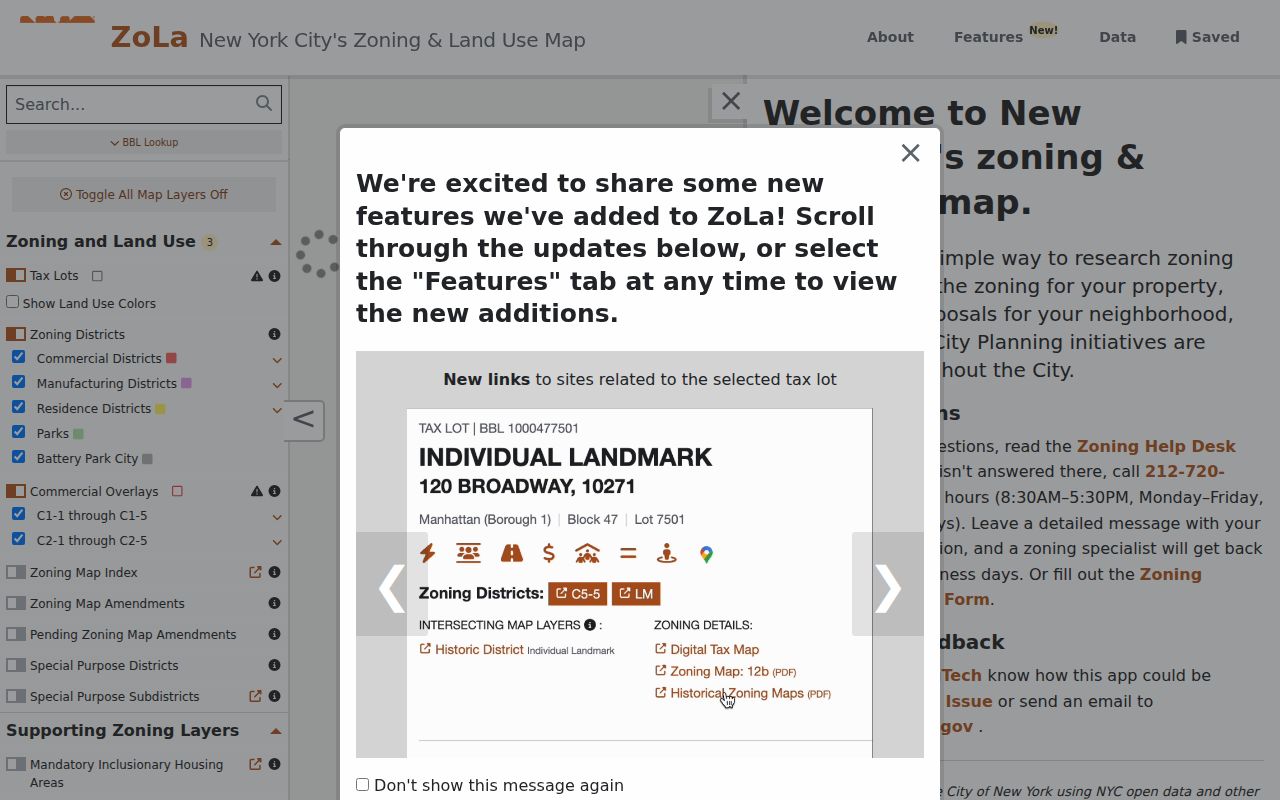
The map provides parcel context after a ZIP has narrowed the area, but its displayed boundaries are informational and not a legal survey.
Note: A postal label narrows delivery geography, while a borough and BBL identify the city records route for a parcel.
New York City ZIP Code Search Fields
The free USPS ZIP Code Lookup is the final delivery-address check. It offers three different tasks, so select the mode that matches the question. An exact address result is not evidence that a named person or company is at that address. It only confirms a postal delivery result, and a unit can help resolve a multiple-match address.
| Mode | Field | Required | Use |
|---|---|---|---|
| ZIP by Address | Street Address | Yes | Enter the street address, with city and state or a ZIP. |
| ZIP by Address | Apt/Suite/Other | No | Add a unit to narrow a multiple match. |
| ZIP by Address | City and State | Yes together | Use the city field and state selector for address mode. |
| ZIP by Address | ZIP Code | No | Check a known ZIP against the address. |
| ZIP by City and State | City / State | Yes | Return the ZIP codes associated with that postal city. |
| Cities by ZIP Code | ZIP Code | Yes | Return cities associated with the entered ZIP. |
USPS calls the controls ZIP Code by Address, ZIP Code by City and State, and Cities by ZIP Code. The second and third modes answer different questions from the address mode. A recognized mailing-city result may differ from a neighborhood or borough label used in a property file.
Queens ZIP Code Address Quirks
Queens is a useful reminder that a ZIP code cannot replace a fully normalized address. House numbers often contain a hyphen, and a tax lot can hold a single address, an address range, or multiple street addresses. Preserve the number exactly as printed before trying a map, a public property search, or historical material. Dropping punctuation can turn one address search into another.
Airport and assigned-building geography adds another layer. ZIP 11370 includes airport or Rikers-related geography, and 11430 is tied to the JFK vicinity. Neither label should be read as a normal neighborhood-wide residential description. Use the full street address and borough, then verify it through USPS before taking the search to a parcel system.
Note: Preserve a Queens hyphenated house number because changing its punctuation can return a different address result.
New York City ZIP Code Workflow
A ZIP code directory narrows geography, but New York City public systems do not all offer a ZIP-wide people search. PIP starts from address, BBL, block, condominium, co-op, REUC, air-lot, or subterranean-lot modes. ZoLa displays ZIP in geographic output and GeoSupport returns a five-digit ZIP in address functions. Those tools connect an address to a parcel rather than producing a list of people.
- Use USPS address mode to confirm the street, unit when needed, city, state, and delivery ZIP.
- Keep the borough with the result, then search the address or BBL in the NYC Property Information Portal.
- Use ZoLa or GeoSupport to review the parcel, blockface, cross streets, BBL, and ZIP output.
- Use the NYC Board of Elections tool only to confirm a known person's exact five-field match: first name, last name, birth date, borough, and ZIP.
- For an entire street after the ZIP is settled, use the address-by-address method on the New York City street directory.
The Board of Elections form has no ZIP browse or street roster. Its result is a match or non-match service and does not promise an address, party, participation history, or full registration record. A voter-data request has an elections-purpose restriction, so it is not a general ZIP list.
Staten Island ZIP Code Records
Staten Island ZIP codes serve Richmond County, a records-custody distinction that matters once a postal search becomes property research. The City Register's ACRIS route covers Manhattan, Bronx, Brooklyn, and Queens from 1966 forward. Staten Island land records instead follow the Richmond County Clerk route. Record the borough as well as the ZIP before looking for a recorded instrument.
This is a geographic interest point within one consolidated city: postal service can call an address Staten Island while land-record custody follows Richmond County. The same care helps with historical descriptions because former localities and county labels may not match a modern mailing label.
Note: A Staten Island ZIP narrows delivery geography, but the recorded-instrument search belongs with the Richmond County custodian.
New York City ZIP Code Limits
New York City ZIP code boundaries and city-record geography overlap, but they are not interchangeable. A property record is best anchored by borough, address, unit, BBL, and document date. A ZIP may describe a PO-box section, a unique institution, a building, or a delivery area that does not match a community district or neighborhood. Use NYCMap's ZIP search as a geographic check, then compare the result with the exact property location.
- ZIP versus ZIP+4
- A five-digit ZIP routes mail to a delivery area. The added four digits narrow the delivery segment and do not define a neighborhood.
- PO-box ZIP
- A ZIP assigned to post-office boxes rather than a normal street-delivery area.
- Unique ZIP
- A ZIP used for a particular institution, building, or special delivery arrangement.
- Carrier route
- A mail-delivery sequence within a ZIP, not a public resident roster or a legal parcel boundary.
Note: Postal verification confirms a delivery result, not a person's connection to the address or a property's legal boundary.
New York City ZIP Code Neighborhoods
Use neighborhood names as helpful search language, not as a final geographic key. Flushing-Murray Hill, Jackson Heights, Corona, Washington Heights, East Flatbush, Gravesend, Sunset Park, Jamaica, Richmond Hill, Woodside, and Queens Village may identify local context, while an official tool can require a borough, BBL, ZIP, census tract, or community district. Matching the tool's requested geography reduces false no-results.
For historical address work, compare the ZIP with cross streets, ward or community district, and map evidence. That gives a more defensible trail than assuming one modern postal label explains every older directory or property record.
New York City’s 1898 consolidation and later borough and county changes add another reason to retain the full address. Older sources can use Brooklyn, Long Island City, Jamaica, Richmond County, West Farms, or another former locality instead of the modern city label. A postal ZIP can help orient a current delivery address, but it cannot convert an earlier town name into a matching historical record. Use the printed locality, borough, street, and date together when moving between a directory, map, property record, or archive index.
For an address near a borough edge, retain the exact USPS result and compare it with the parcel record before choosing a records office. The borough code in a city data system, rather than a ZIP alone, determines the property-search path. That small check prevents a postal search from sending a researcher to the wrong county clerk, map layer, or historical collection.