
Trace a New York City Street
Address research in New York City begins with the borough. Use the exact house number, street, unit, and cross streets where possible. The Department of Finance turns that location into a BBL, then ACRIS, ZoLa, DOB, HPD, and archives can be searched for different kinds of evidence. A property owner, a recorded party, and an occupant are different categories, so label each result by what it actually shows.
New York City’s five boroughs also have different record paths. ACRIS covers Manhattan, the Bronx, Brooklyn, and Queens online from 1966. Staten Island land records belong with the Richmond County Clerk. Older four-borough instruments require a City Register office follow-up, while historic address books and maps are held through libraries and archives.
- Enter the address in the Department of Finance Property Information Portal and note borough, block, lot, unit, and owner-of-record field.
- Open ZoLa or GeoSupport to normalize the street segment, cross streets, parcel boundaries, and nearby BBLs.
- Use the BBL or address lookup in ACRIS, then inspect document date, party role, and legal description before following a deed.
- Search BIS, DOB NOW, and HPD for address-keyed permits, complaints, violations, registrations, or filings. Both DOB systems are needed.
- For earlier occupants, test the exact address in a reverse or criss-cross directory and then pair it with a dated map, census, or archive record.
New York City Street Directory BBL Key
BBL means borough-block-lot. It is more reliable than an address alone because a house number can be renumbered, a building can have several entrances, and a lot can be merged or split. The ACRIS address and BBL lookup asks for borough, street, house number, unit when needed, block, and lot. Record the version returned by the official system.
The lookup screen below is the bridge from a written street address to the parcel reference used in other New York City records.
Once the BBL is known, it can be compared against the property portal, a recorded document, map layers, and historic property material without guessing at a street-name variation.
- Parcel
- A tax or legal land unit, usually identified through a BBL.
- Situs address
- The location of the parcel or building, used by maps and property search.
- Mailing address
- The address used for notices; it can belong to an agent, office, entity, or another property.
- Criss-cross directory
- An address-ordered historical directory that may identify people or businesses recorded at a location in a given year.
New York City Address Search Fields
The Property Information Portal is designed for property-first research. Its entry modes are an address, borough/block/lot, borough/block, condominium number, co-op development number, REUC identifier, air lot, and subterranean lot. The page does not present a public citywide owner-name field, so start with the address or BBL and read owner information in the returned detail.
| Portal field | Required input | Street-directory use |
|---|---|---|
| Address | Address, intersection, or common place name | Locates a property and map context |
| Borough / Block / Lot | Borough plus block and lot | Reaches a known parcel |
| Borough / Block | Borough plus block | Reviews lots on one tax block |
| Condominium / co-op | Borough and listed number | Handles development records |
| Air / subterranean lot | Borough, block, lot | Checks special tax-lot situations |
The property portal image shows the address-led route.
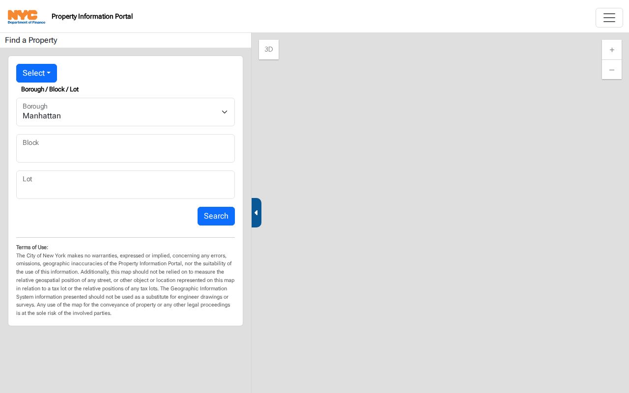
A returned owner or mailing field is a property clue. It does not establish who occupies every unit or receives mail at the building.
New York City Street Layers in ZoLa
ZoLa and GeoSupport add the map layer that a street directory needs. ZoLa accepts an address, BBL, BIN, or map interaction. A selected lot can show address, borough, block, lot, zoning district, land use, building details, historic-district status, police precinct, and links to related information. Its layer groups include zoning, land use, landmarks, waterfront, environmental requirements, and administrative areas.
For a street segment, locate one address, turn on parcel boundaries, then click lots along the frontage. GeoSupport’s address, intersection, street, and street-stretch functions can normalize cross streets and blockfaces. The map is a geographic bridge, not a legal survey or a household list.
The ZoLa parcel viewer below illustrates the lot-level context available around an address.
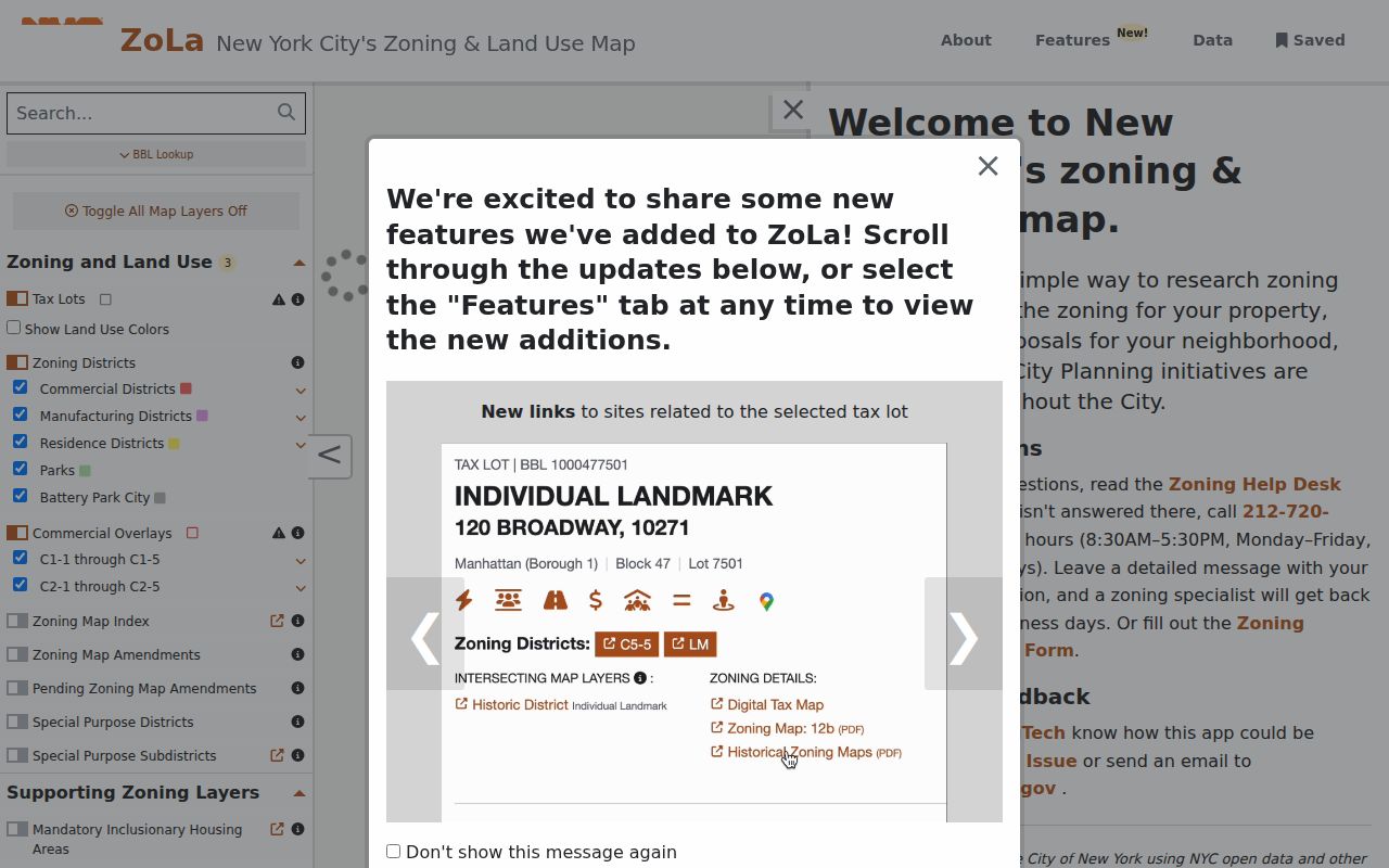
Use a map boundary and BBL to define the records being compared, especially on a corner, in a large complex, or where a building uses multiple addresses.
New York City Records by Street
Street-based records should be read as a chain, not a single answer. The Department of Finance supplies property and tax context. ZoLa and GeoSupport supply parcel geography. ACRIS supplies recorded instruments for four boroughs. BIS, DOB NOW, and HPD provide address-keyed building events. Libraries and archives hold the older address books, maps, and property cards that can place a household in a historical year.
| Address-keyed source | What it can show | Access channel |
|---|---|---|
| DOF PIP | BBL, property details, owner-of-record, tax context | Free address, BBL, or block portal |
| ZoLa / GeoSupport | Parcel, blockface, zoning, geographic attributes | Free viewer and service |
| ACRIS | Recorded deeds, mortgages, liens, parties, dates, CRFN | Free four-borough online index from 1966; City Register counter earlier |
| Richmond County Clerk | Staten Island land documents | Clerk route; confirm current counter or request procedure |
| BIS, DOB NOW, HPD | Permits, violations, complaints, registrations, building events | Free online systems plus agency request paths |
| Directory and map collections | Historical street, building, and occupant context | NYPL, BPL, DORIS digital, microfilm, and appointment access |
Note: A tax lot or recorded document can be public while the identity of every resident remains outside the record.
New York City Deed Chains by Address
ACRIS has party name, parcel identifier, document type, document ID or CRFN, transaction number, reel and page, and UCC or federal-lien search modes. Open the relevant instrument and compare the BBL, legal description, document date, recording date, and party roles. Then search an earlier seller as a grantee in an earlier time range. A mortgage or easement can affect the property without transferring the whole parcel.
The ACRIS main page provides the property-record route pictured here.
ACRIS begins online in 1966 for its four covered boroughs. Stop at that coverage boundary and use the City Register office, Richmond County Clerk, Municipal Archives, or library materials for the next layer.
The online cutoff does not mean New York City land history begins in 1966. For an earlier instrument in Manhattan, Brooklyn, Queens, or the Bronx, ask the City Register business office in the borough where the document was recorded. Give the address, BBL when known, names of the parties, a narrow date range, and the document or copy sought. On Staten Island, start with the Richmond County Clerk rather than assuming the four-borough ACRIS search will supply the missing series. A counter, clerk request, or archive finding aid is more useful than broadening a party-name query until it returns unrelated records.
Manhattan has an additional historical indexing story. A state-law effort beginning in 1910 led to the abstraction of more than 630,000 pre-1891 conveyances between 1911 and 1916. The resulting chronological key-block material was opened in 1917. Nineteenth-century Manhattan title work may therefore require a numbered key block or older legal description instead of current BBL vocabulary. Preserve the key block, page, party spelling, document date, recording reference, and collection location with each result. A deed trail is strongest when that recorded description remains consistent from one instrument to the next.
ACRIS also separates document searching from reading the actual result. Document-type searches use document class, document type, From and Through dates, and borough or county controls. Result rows lead to detail and image views where available. Save the CRFN or document ID, the parcel reference, and the source date before moving to another record. The City Register index is a recorded-document source, not a shortcut to a complete occupancy history.
For a later copy, keep the index number and ask whether an image, ordinary copy, or certified copy is needed. Each serves a different purpose and may require a separate custodian request.
New York City Street Building History
BIS is the older Department of Buildings system, while DOB NOW holds newer filings that do not appear in BIS. Search both before deciding that an address has no building history. BIS supports address, BBL, BIN, complaint, violation, application, and several equipment modes. DOB NOW, HPD, and NYC Open Data can add filings, property registration, charges, litigation, complaints, and violations.
A New York City street directory gains useful dates from these systems. A permit can mark construction or alteration, while a complaint or violation records a separate event. Keep the event type and result date with the record instead of converting a filing into a claim about a household.
These records describe an address-related event or filing. An applicant, architect, owner, managing agent, or registered contact is not automatically a resident. Plans are not public in the DOB NOW portal. The documented fallback is a DOB record request, with available material picked up through the relevant borough office.
New York City Street Directory History
Historical street work often needs a different shelf. NYPL holds New York City directories from 1786–1934, while the Center for Brooklyn History has Brooklyn directories, telephone books, Elite and Blue Book volumes, and criss-cross runs from 1929–1931, 1933–1961, 1963–1970, 1972–1980, and 1986. Old addresses can be checked against Sanborn and other property atlases, tax cards, tax photos, census records, newspapers, and probate sources.
Queens deserves extra care. House numbers can be hyphenated, a tax lot may use a range or multiple addresses, and former-town names can appear in older records. Borough, old street spelling, cross street, ward, and BBL are better search anchors than a modern address alone. The detailed historic shelf is available through the New York City Directory Book.
New York City Street Voter Limits
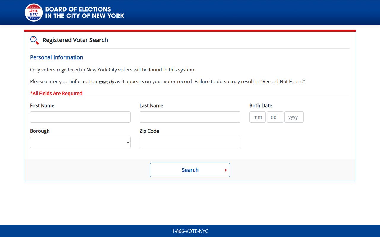
The NYC voter lookup requires a known first name, last name, birth date, borough, and ZIP Code. It is not a street directory, map browse, or block roster. The self-service result cannot be used to turn an address list into a list of registered voters. Full-file requests have an elections-purpose certification requirement under Election Law §3-103(5).
The official lookup form below shows why a street-only query cannot be run through the public service.
Keep protected and confidential voter information outside a street research project, even when an address is otherwise public.
Limits of a New York City Street Directory
An address record can show a parcel, a recorded instrument, a building event, or a historic directory entry. It cannot safely be turned into a current household roster. Non-owner occupants, household members, protected voters, utility customers, and visitors are not supplied by the public parcel tools. A mailing address and an owner name should never be relabeled as a resident without independent, dated evidence.